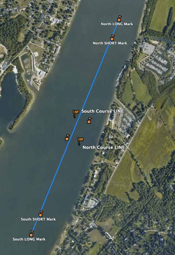
Wednesday Mark Locations
Wednesday Waypoints
North LONG Mark
Latitude: 38°20.0146’N
Longitude: 085°38.7261’W
North SHORT Mark
Latitude: 38°19.9091’N
Longitude: 085°38.7703’W
South Course LINE Boat
Latitude: 38°19.470‘N
Longitude: 085°38.9752‘W
North Course LINE Boat
Latitude: 38°19.3428‘N
Longitude: 085°38.9440‘W
South SHORT Mark
Latitude: 38°18.9573’N
Longitude: 085°39.2128’W
South LONG Mark
Latitude: 38°18.8513’N
Longitude: 085°39.2696’
NOTES:
Mark locations are approximate with actual locations dependent on windspeed and direction, current and other considerations as determined by the Committee at the time of their placement at 1600. Starting lines are set by placing the Committee Boat per its target GPS waypoint, and then placing the Pin approximately 150 yards away, attempting, within reason, to make the line perpendicular to the wind as projected to be at 1800. The target distance between the long and short marks is 220 yards (1/8 mile) with the Start/Finish Line set approximately 220 yards further away from the windward mark than the leeward mark.